-
CarryMap for Android
- About the app
- Application terminology
- Section 1. Getting started and configuring the app
- Section 2. Application data
- Section 3. Opening maps and creating projects
-
Section 4. Creating and editing features
- About GeoPackage
- Creating new features
- Creating features by coordinates
- Creating point feature by photo
- Creating points with single tap
- Recording track
- Selecting symbol when creating feature
- Adding attachments to feature
- Filling in fields using QR code
- Editing features
- Adding and viewing Z coordinates
-
Section 5. Additional functionality
- Track log
- Use as a destination point
- Searching features
- Measuring on the map
- Circular ruler
- Creating marks
- Creating bookmarks
- Save map extent
- Selecting map scale
- Finding current location
- Sharing location information
- Displaying information from GPS/GLONASS receiver in the map window
- Use external GPS receivers
Automatic data conversion
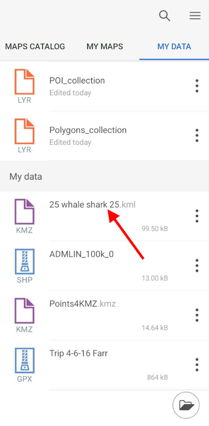
The CarryMap application works directly and provides access to create and edit objects in layers of GeoPackage format files (see Creating new features and Editing features ). When opening data of other supported formats (KML/KMZ, GPX, SHP), automatic conversion to GeoPackage format occurs.
To open the data of KML/KMZ, GPX or SHP format, go to the page for adding data and select the My data section (see Page for adding data and maps ). Click on the selected file, the file will be automatically converted to the GeoPackage layer.
|
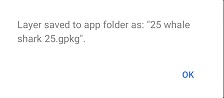
After successful conversion, you will see the corresponding message.
|
In the window that appears, click OK .
Converted gpkg layer will be added to the project.