-
CarryMap for Android
- About the app
- Application terminology
- Section 1. Getting started and configuring the app
- Section 2. Application data
- Section 3. Opening maps and creating projects
-
Section 4. Creating and editing features
- About GeoPackage
- Creating new features
- Creating features by coordinates
- Creating point feature by photo
- Creating points with single tap
- Recording track
- Selecting symbol when creating feature
- Adding attachments to feature
- Filling in fields using QR code
- Editing features
- Adding and viewing Z coordinates
-
Section 5. Additional functionality
- Track log
- Use as a destination point
- Searching features
- Measuring on the map
- Circular ruler
- Creating marks
- Creating bookmarks
- Save map extent
- Selecting map scale
- Finding current location
- Sharing location information
- Displaying information from GPS/GLONASS receiver in the map window
- Use external GPS receivers
Adding and viewing Z coordinates
Adding Z coordinates to point features
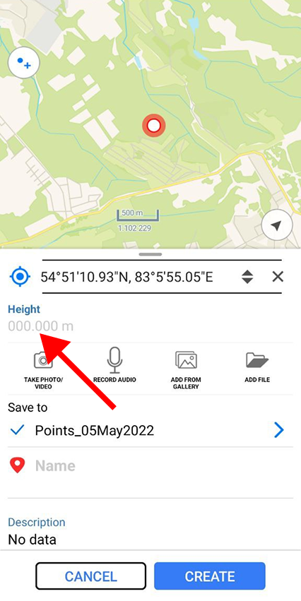
Adding Z coordinates (heights) to point features is available when creating and editing features on the map.
Note that adding and editing the Z coordinate values of point features is only available in GeoPackage layers that support storing information about the height of features.
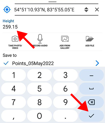
To add or edit Z coordinate (height) value of a point feature, during the process of creating or editing feature go to the value entry line in the Height field of the feature identification card (see Creating new features and Editing features sections for details).
|
Enter the value and press Done on the keyboard.
|
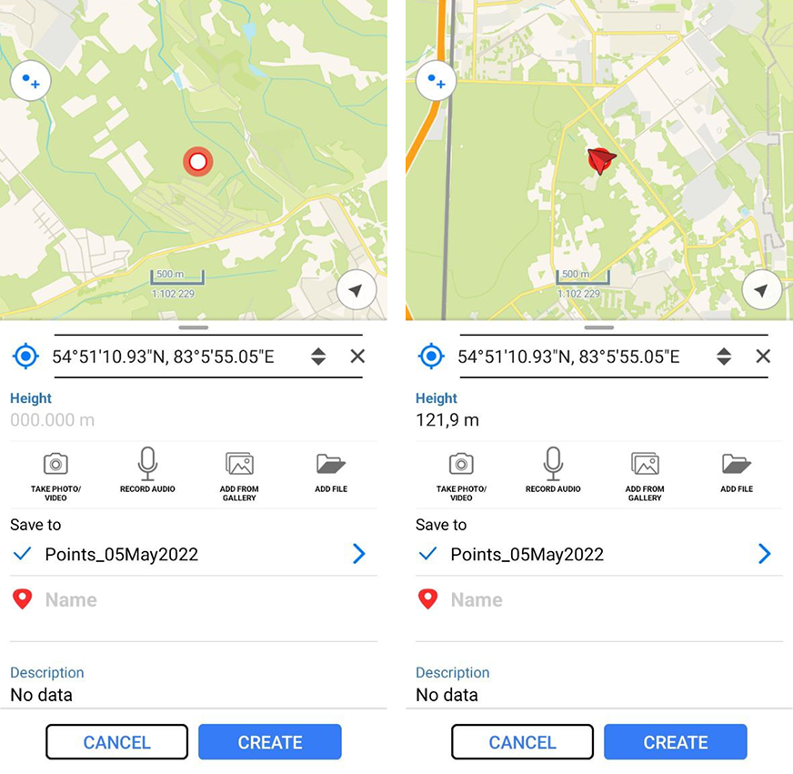
To add Z coordinate (height) of a point feature from GPS module of the device, press
Coordinates by location
![]() button.
button.
The value in the Height field will be changed to Z coordinate value obtained from the GPS module of the device.
|
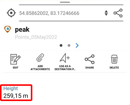
Viewing Z coordinates of point features
Information about Z coordinate (height) of GeoPackage point features is displayed in the additional virtual field Height in the feature identification card.
|
The units selected in the Application settings are used as the measurement units.