-
CarryMap for Android
- About the app
- Application terminology
- Section 1. Getting started and configuring the app
- Section 2. Application data
- Section 3. Opening maps and creating projects
-
Section 4. Creating and editing features
- About GeoPackage
- Creating new features
- Creating features by coordinates
- Creating point feature by photo
- Creating points with single tap
- Recording track
- Selecting symbol when creating feature
- Adding attachments to feature
- Filling in fields using QR code
- Editing features
- Adding and viewing Z coordinates
-
Section 5. Additional functionality
- Track log
- Use as a destination point
- Searching features
- Measuring on the map
- Circular ruler
- Creating marks
- Creating bookmarks
- Save map extent
- Selecting map scale
- Finding current location
- Sharing location information
- Displaying information from GPS/GLONASS receiver in the map window
- Use external GPS receivers
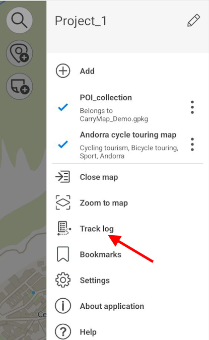
Track log
All tracks are automatically recorded by the app in the tracks log. Here you can find and restore any track even if an error occurred and the application was interrupted.
To view all tracks, go to Track log section in the project menu.
|
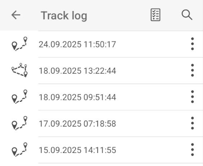
The list with all tracks will appear. Tracks are sorted by date and time they are recorded.
|
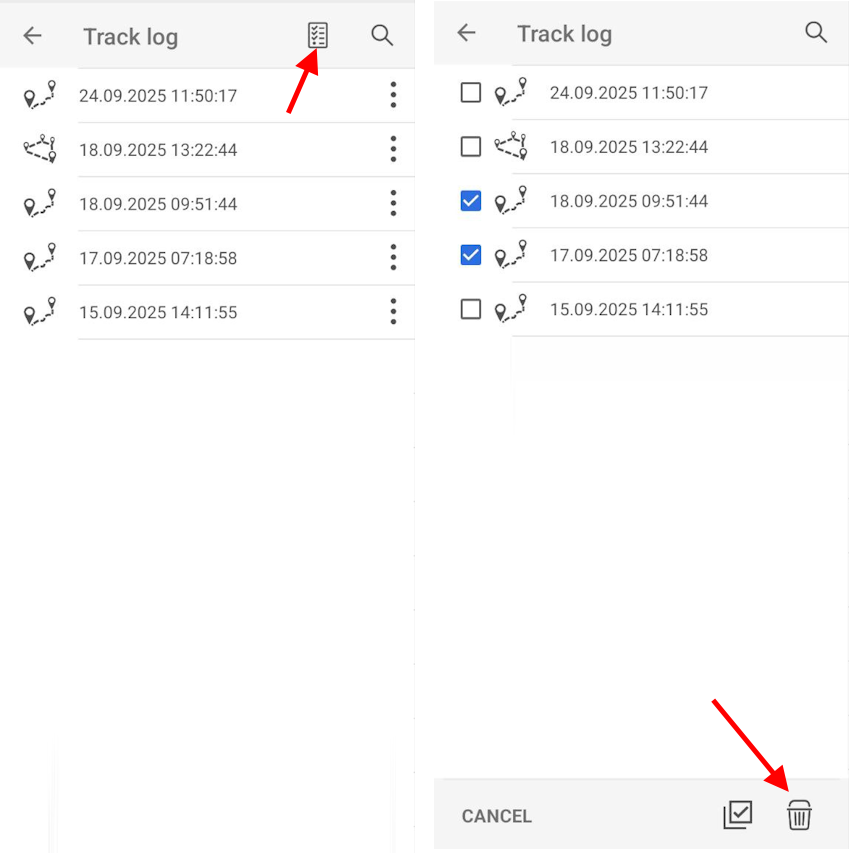
To delete the track, tap three dots and select Delete from device .

|
If you need to delete multiple tracks, tap Select all button, select the required tracks and then tap Delete .
|
To restore the track, select it from the list. The geometry of the selected track will be displayed on the map.

|
To save the track, press Create .