-
CarryMap for Android
- About the app
- Application terminology
- Section 1. Getting started and configuring the app
- Section 2. Application data
- Section 3. Opening maps and creating projects
-
Section 4. Creating and editing features
- About GeoPackage
- Creating new features
- Creating features by coordinates
- Creating point feature by photo
- Creating points with single tap
- Recording track
- Selecting symbol when creating feature
- Adding attachments to feature
- Filling in fields using QR code
- Editing features
- Adding and viewing Z coordinates
- Section 5. Additional functionality
Sharing data
The CarryMap application supports the ability to share all application data.
Take advantage of the new ability of exchanging projects between the mobile and the desktop app versions. The new format of the project’s archive, CMPRJ, is common for all app platforms (Android, iOS, Windows).
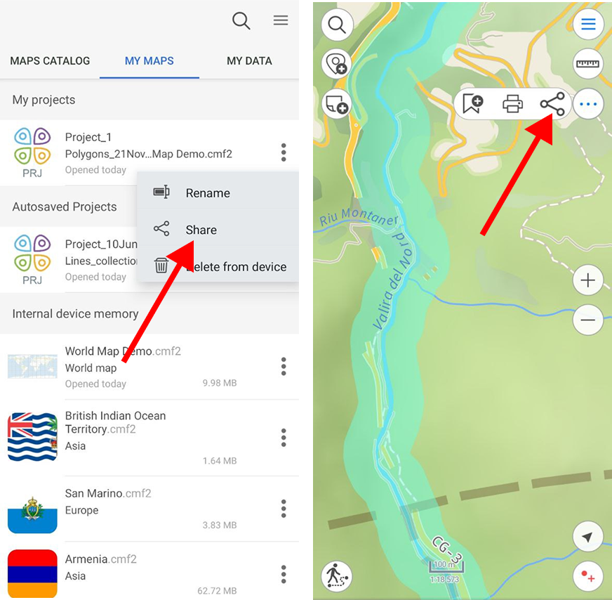
In the mobile version of the app you can share a project both from the list of maps and projects at the “My maps” tab of the application start window and from the map window.
To share a project at the My Maps tab, open the project menu by tapping three dots and select Share .
The project can also be shared from the map window. To do this, go to the Additional tools for working with the map and click the Share button.
|
Then select the desirable method to use to share the project archive file.
You can also send your maps, layers and datasets, as well as links to online mapping services from the catalog of maps and data and from the list of project layers.
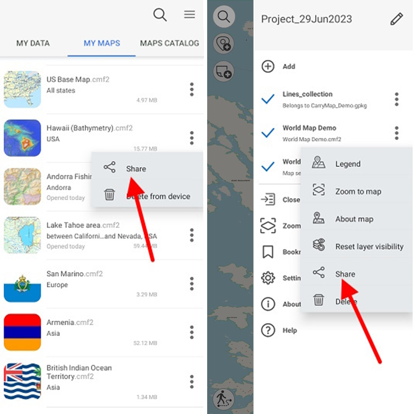
To share a CMF2 file open the maps menu on the My Maps tab on the start page or the Page for adding data and maps layers by tapping three dots and select Share .
The CMF2 map can also be shared from the list of project layers. To do this, open the layer menu and select Share .
|
Then select the method you want to use to share the map file.
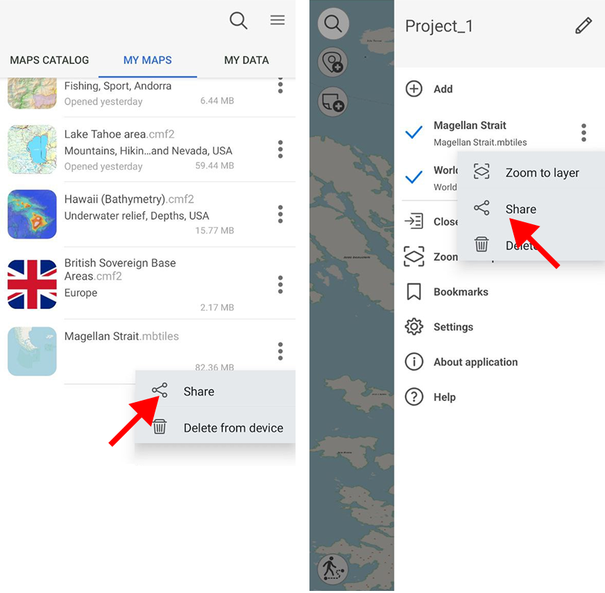
To share a MBTILES file, open the map menu on the My Maps tab on the start page or the Page for adding data and maps layers by tapping three dots and select Share .
The MBTILES map can also be shared from the list of project layers. To do this, open the layer menu and select Share .
|
Then select the method of sharing the map file.
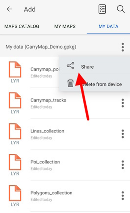
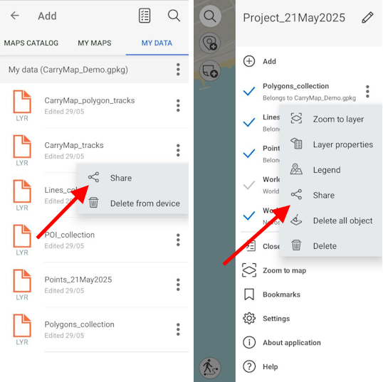
To share GeoPackage datasets, .KML/.KMZ, .GPX or .SHP, select the My data tab, open the file menu by tapping three dots, and select Share .
|
Then select the method you want to use to share the file.
To share GeoPackage file layer, select the My data tab, or open the file menu by tapping three dots, and select Share .
|
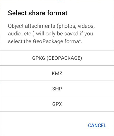
In the appeared dialog, select the data format.
|
After selecting the format, select the method you want to use to share the file.
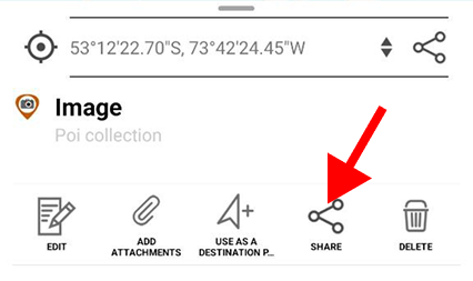
Besides, you can share one object of the GeoPackage layer by tapping on it in the map window and selecting Share in the card that opens.
|
In the appeared dialog, select the data format.
|
|
After selecting the format, select the method you want to use to share the file.
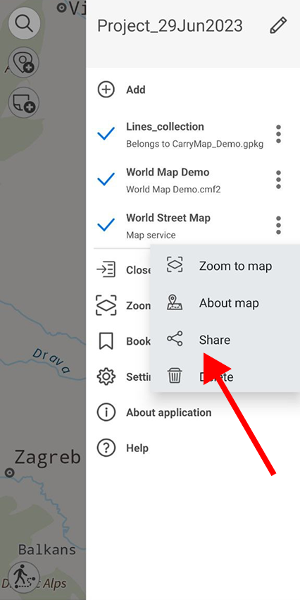
To share a link to an online mapping service, open the layer menu in the project layers list by tapping three dots and select Share .
|
Select the method to share the link.