-
CarryMap for Android
- About the app
- Application terminology
- Section 1. Getting started and configuring the app
- Section 2. Application data
- Section 3. Opening maps and creating projects
-
Section 4. Creating and editing features
- About GeoPackage
- Creating new features
- Creating features by coordinates
- Creating point feature by photo
- Creating points with single tap
- Recording track
- Selecting symbol when creating feature
- Adding attachments to feature
- Filling in fields using QR code
- Editing features
- Adding and viewing Z coordinates
- Section 5. Additional functionality
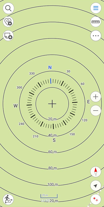
Circular ruler
The circular ruler is used to determine distances and directions on the map in real time.
The circular ruler consists of:
- Limbus used to determine direction of the sides of the horizon on the map;
- Set of circular zones showing the distance from the center of the screen.*
|
* NOTE: Zones sizes are calculated automatically depending on the map scale. The distances are displayed in the units specified in the Application settings .
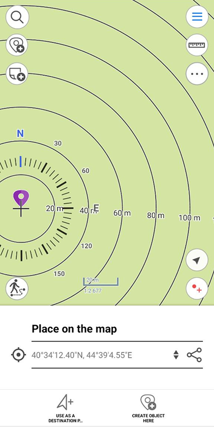
The elements of the circular ruler are linked to the identification pushpin. When objects are identified, the map automatically positions to the identification pushpin, and the center of the circular ruler does not change its position when map is panned, or map scale is changed.
|
To display the circular ruler in the center of the screen again, close the identification card.
|
|
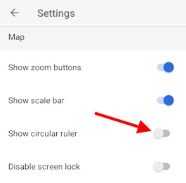
The display of the circular ruler in the map is disabled by default.
To enable display of the circular ruler on the map, go to Application settings and pull the switch in the Show circular ruler section.
|